|
| *****SWAAG_ID***** | 282 |
| Date Entered | 04/10/2011 |
| Updated on | 18/11/2012 |
| Recorded by | Alan and Judith Mills |
| Category | Mining Related |
| Record Type | Mining |
| SWAAG Site | Hagg Farm |
| Site Access | Private |
| Record Date | 29/09/2011 |
| Location | Fremington Edge on the south side of the wall separating the moor from the enclosed land |
| Civil Parish | Grinton |
| Brit. National Grid | SE 053 996 |
| Altitude | 410m |
| Geology | Limestone (Main Lime?) |
| Record Name | Bale sites (for smelting lead ore) |
| Record Description | Prior to the introduction of water-powered smelt mills ca.1580, bales were used to smelt lead ore. A bale was little more than a simple wind-blown structured bonfire, fuelled with wood, peat and sometimes coal.
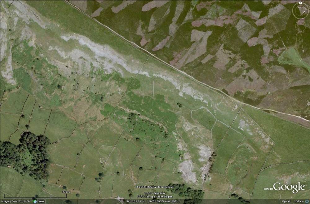
There are a large number of bales in this area extending along the top of the fields above Hagg Plantation and below the track which runs along the top of Fremington Edge from Reels Head (known as Wayne's Way)- see Google Earth image. In addition to the bale sites there are also several small limestone quarries, possibly to make lime for use in the smelting process.
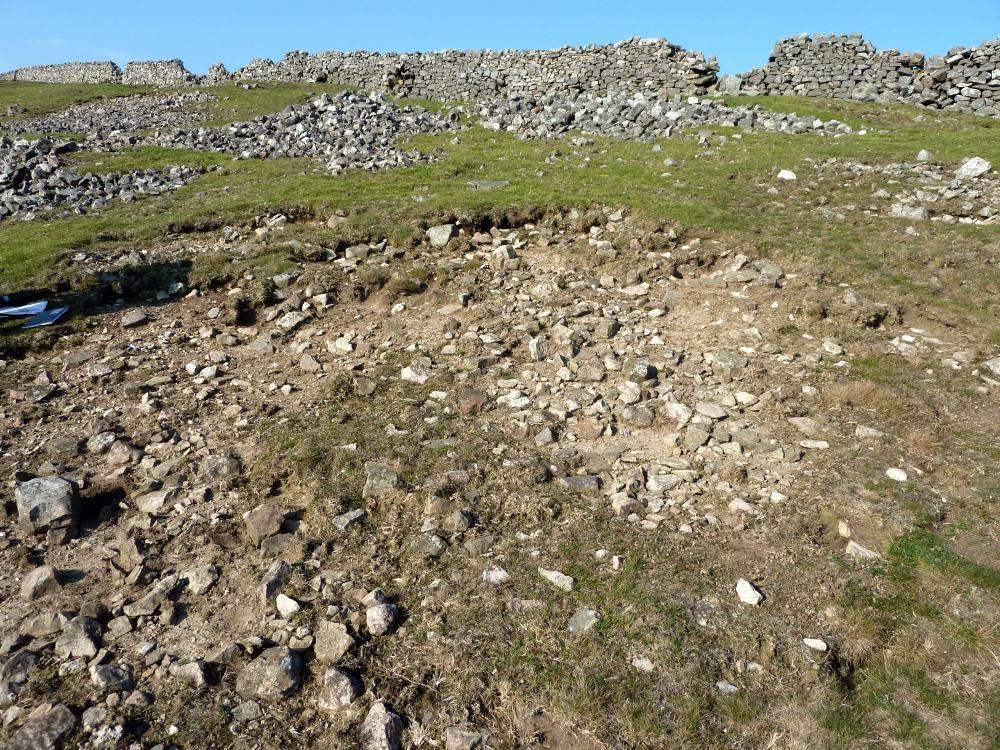
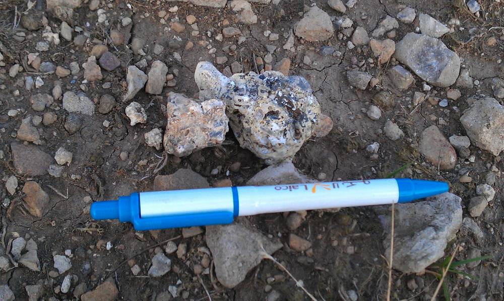
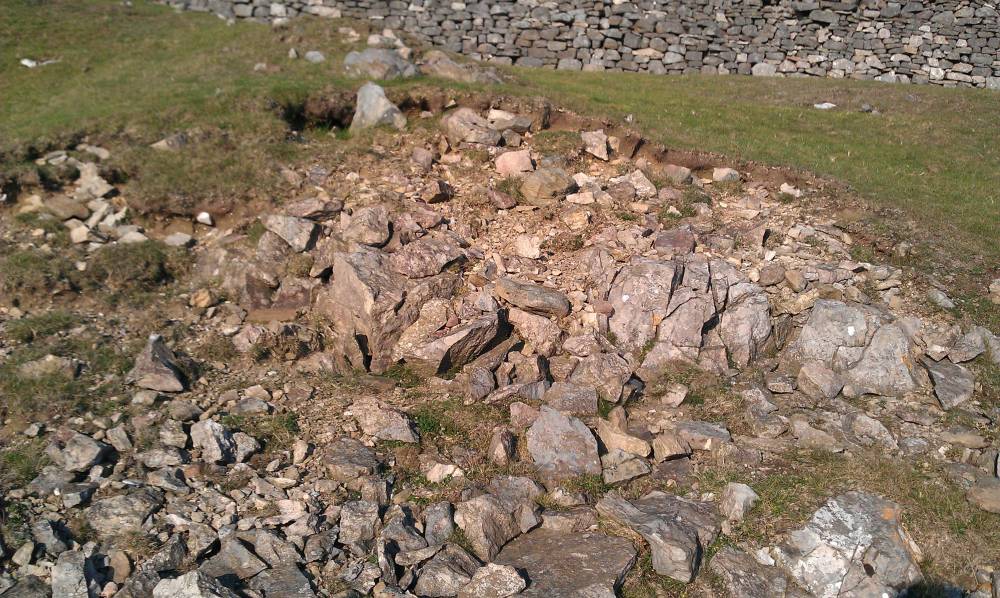
Two bale sites were recorded by Stephen Eastmead & Alan Mills in September 2011 and are noted here; one at SE 06039 99272 (site 1), the other at SE 05983 99333 (site 2). Both sites have small amounts lead ore (Galena) present. Site 2 seems to be situated on a small natural limestone outcrop. This would be unusual - see below.
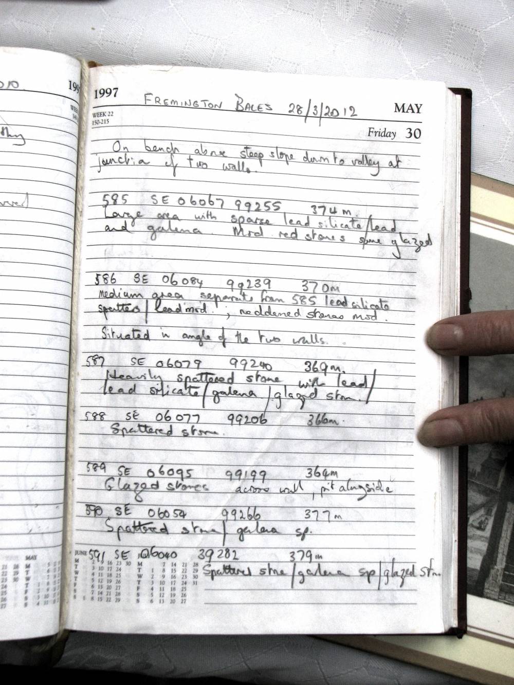
The site was revisited in March 2012 by Alan Mills & Richard Smith who identified a number of other bales. The bales are located on two sandstone benches with a band of limestone in between. Smelters seemed to prefer sandstone as it would not crack as readily as limestone, which would allow molten lead to escape. The bale sites were identified by the visible presence of lead silicate, lead prill and splatter and occasional glazed stones. Examination of the sites found no barytes or calcite, although the latter would probably have burnt off to form quick lime which would be washed away by rain. This suggests high quality dressed ore was smelted here. It is difficult to identify precisely where the bales were located. The spread of material and the presence of a number of shallow pits suggests the bales were dug out to recover any remaining lead and slag. This was probably ca. 1660 when Les Tyson (see - A history of the manor and lead mines of Marrick; British Mining 38; 1989; p23) notes that 925 horse loads of slag were removed from the old bale hill sites on Fremington Edge to be re-smelted in the slag hearth of the Low Mill, Marrick.
The site is probably medieval in date and potentially of national importance.
Photos 1 - 6 by Stephen Eastmead & Alan Mills. All others by Alan Mills. Note that the field notes are by Richard Smith.
|
| Image 1 ID | 1058 Click image to enlarge |
| Image 1 Description | Google Earth image of Hagg high fields showing bale / quarry / scree area | 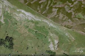 |
| Image 2 ID | 1059 Click image to enlarge |
| Image 2 Description | Hagg bale site 1 | 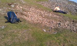 |
| Image 3 ID | 1060 Click image to enlarge |
| Image 3 Description | Hagg bale site 1 | 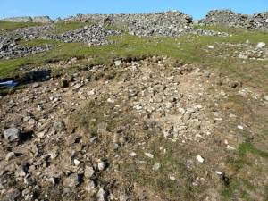 |
| Image 4 ID | 1061 Click image to enlarge |
| Image 4 Description | Lead ore (galena) at bale site 1 |  |
| Image 5 ID | 1062 Click image to enlarge |
| Image 5 Description | Hagg bale site 2; note the natural limestone base |  |
| Image 6 ID | 1063 Click image to enlarge |
| Image 6 Description | Small pieces of lead ore (galena) at bale site 2 | 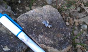 |
| Image 7 ID | 2538 Click image to enlarge |
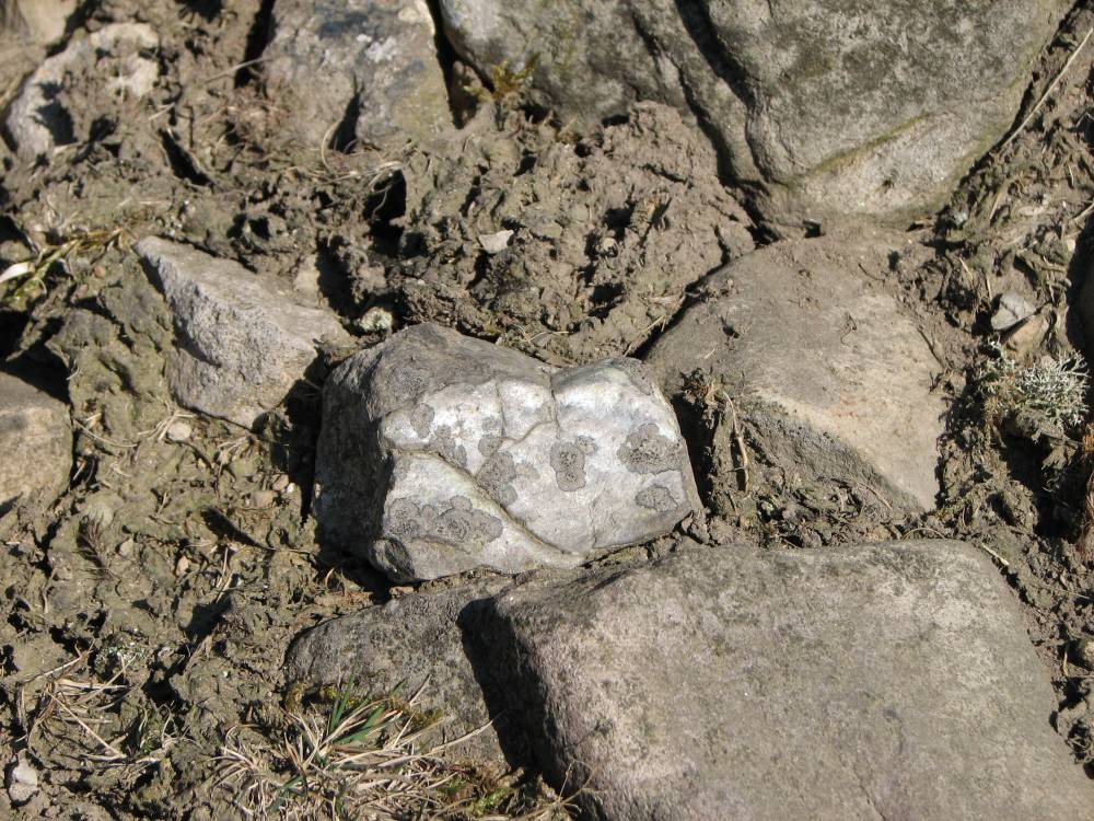
| Image 7 Description | Lead and lead silicate attached to a stone indicating it had been in a bale during smelting | 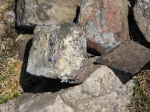 |
| Image 8 ID | 2539 Click image to enlarge |
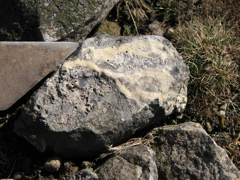
| Image 8 Description | Lead glaze on a stone indicating it had been in a bale during smelting |  |
| Image 9 ID | 2540 Click image to enlarge |
| Image 9 Description | Lead silicate run-off indicating that the stone had been in a bale during smelting | 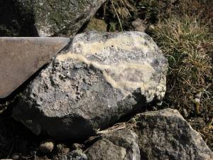 |
| Image 10 ID | 2541 Click image to enlarge |
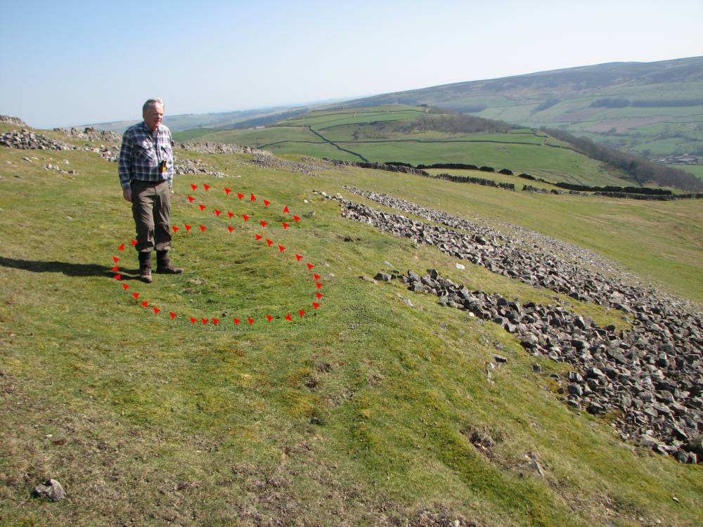
| Image 10 Description | A line of shallow pits with spoil below, including stones similar to above - two of the pits are marked out. It is likely that these mark the sites of the bales which were later dug out to recover any remaining lead and/or slag.
|  |
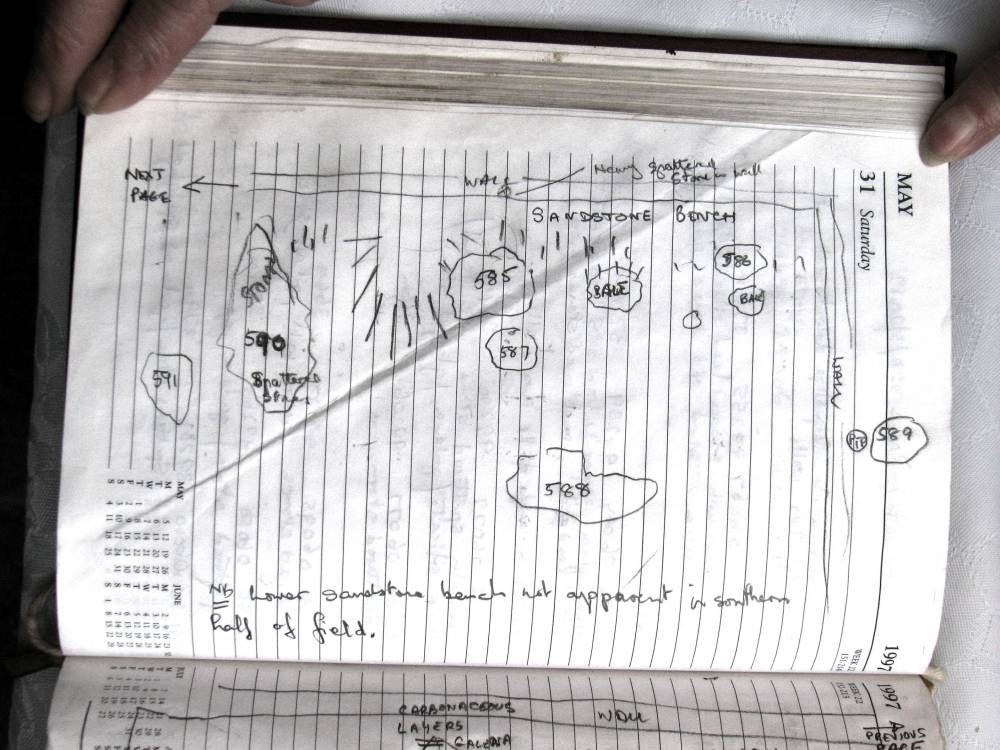
| Image 11 ID | 2542 Click image to enlarge |
| Image 11 Description | The following images are of Richard Smith's field notes and provide details of the bales identified | 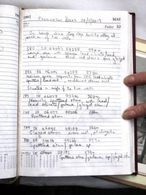 |
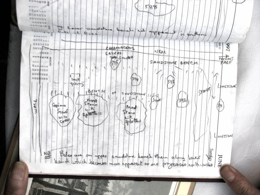
| Image 12 ID | 2543 Click image to enlarge |
| Image 12 Description | Richard Smith's field notes page 2
nb the NGR for entry 591 should read SE 06040 99282 not as shown | 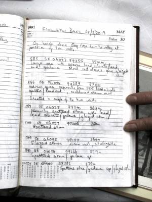 |
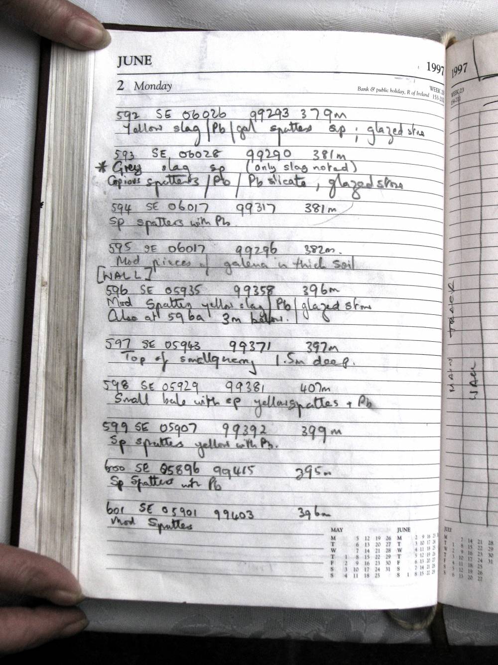
| Image 13 ID | 2544 Click image to enlarge |
| Image 13 Description | Richard Smith's field notes page 3 | 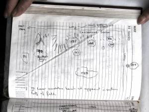 |
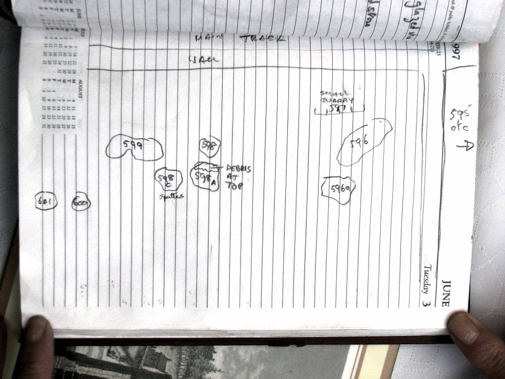
| Image 14 ID | 2545 Click image to enlarge |
| Image 14 Description | Richard Smith's field notes page 4 | 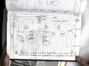 |
| Image 15 ID | 2546 Click image to enlarge |
| Image 15 Description | Richard Smith's field notes page 5 | 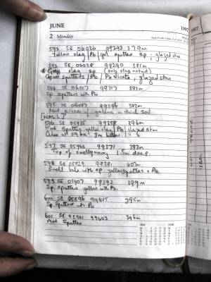 |
| Image 16 ID | 2547 Click image to enlarge |
| Image 16 Description | Richard Smith's field notes page 6 | 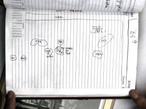 |
| Image 17 ID | 2548 Click image to enlarge |
| Image 17 Description | Richard Smith sitting by one of the bales | 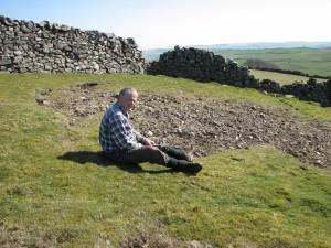 |
| Image 18 ID | 3692 Click image to enlarge |
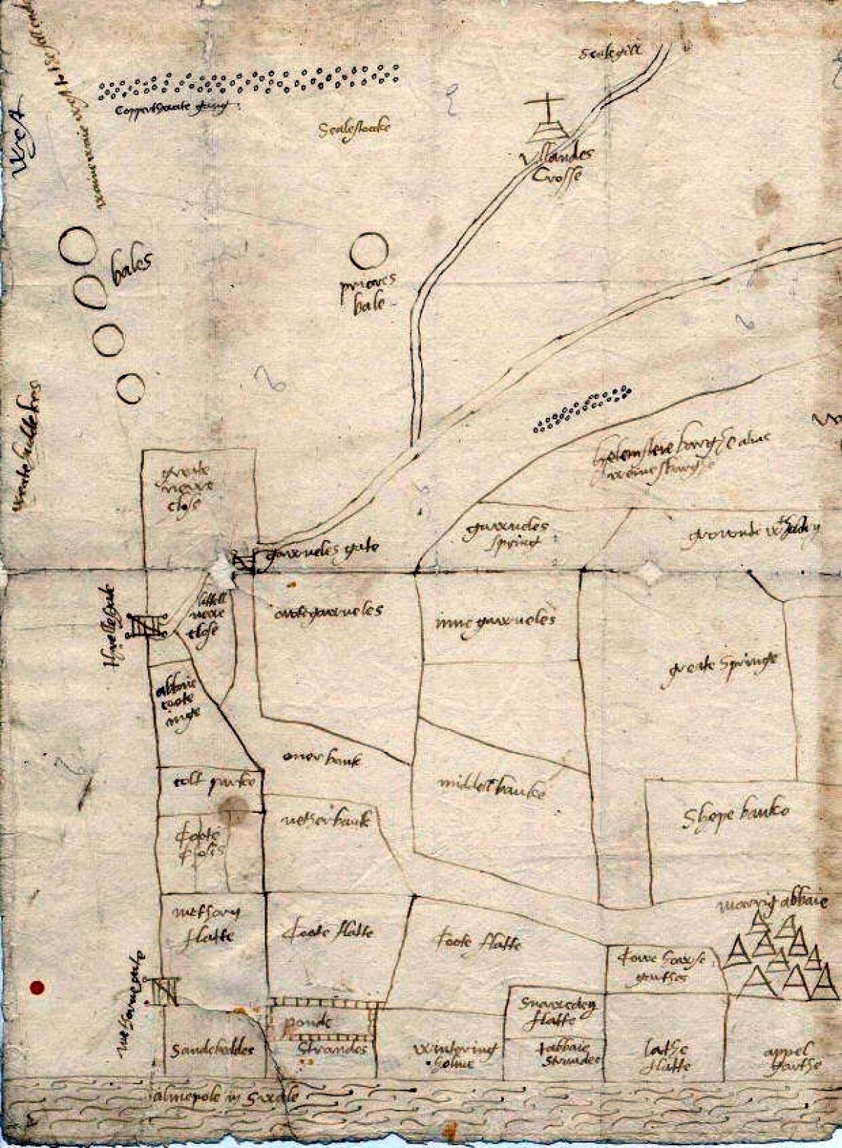
| Image 18 Description | Marrick Priory land map | 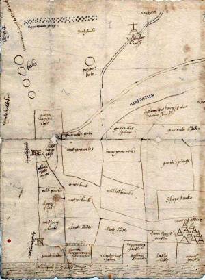 |